It is important to respect other trail users and support the organizations that maintain the trails where ever you ride.

Tips on how to ride safely and responsibly.

Vancouver, Coast & Mountains

Sunshine Coast

Photo by Margus Riga

Year-Round Biking Wonderland

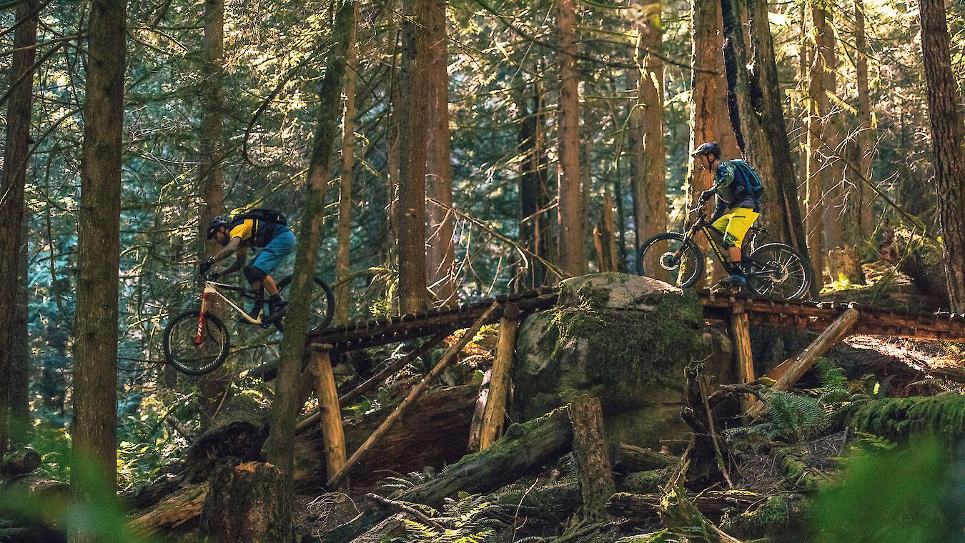
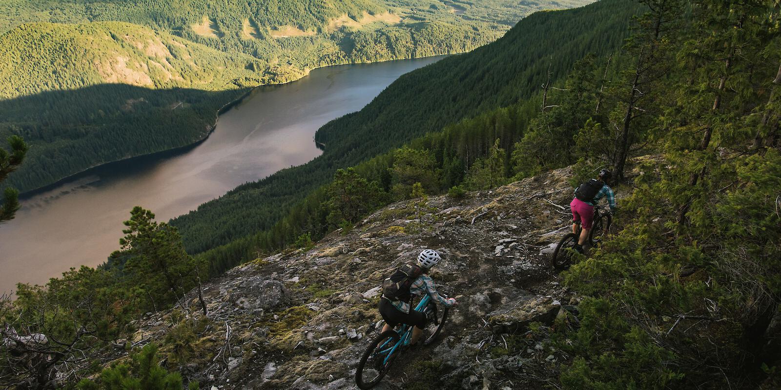
There is no need for your bike to stay unused in the shed when you can ride the Sunshine Coast year-round. The array of terrain—from adrenaline pumping downhill to technical cross-country—accommodates every style and level of rider. The Southern Sunshine Coast—a short 40-minute ferry from Horseshoe Bay—is known for its smooth flow trails through spectacular scenery while the Northern Sunshine Coast is notorious for its phenomenal cross-country riding through vibrant old-growth forests.

Sprockids Park, just minutes from the ferry boasts fantastic trails for all levels of riders and B&K network in Roberts Creek has all the fast and fun downhill tracks. For cross-country enthusiasts, West Sechelt is the name, and for downhill gravity fun all day the Coast Gravity Park is BC's first shuttle-accessed, year-round downhill bike park. Travel a little further north to Powell River for challenging, technical, and fast trails maintained by a thriving and committed community of local riders and trail builders.

Number of Trails:
693
Highest Elevation:
1,852 m
Trails:
easy
211
intermediate
395
difficult
76
extra difficult
11

Sunshine Coast Inspiration

Stories from the Sunshine Coast.

Getting Here & Trail Access

The Sunshine Coast stretches for 180 km (110 mi) along the Salish Sea from Howe Sound to Desolation Sound and is divided in the Northern Sunshine Coast and Southern Sunshine Coast by Jervis Inlet. Although it is part of BC’s mainland, access to the region is by BC Ferries or by air due to the mountainous terrain.

To bring your vehicle to the Sunshine Coast, you must take BC Ferries scheduled service to Langdale/Gibsons (Southern Sunshien Coast) or to Powell River (Northern Sunshine Coast). Reservations are strongly recommened, although not required, as long wait times can occur during busy summer months.

Driving Distances & Times to Langdale/Gibsons (Southern Sunshine Coast):

  • Vancouver - 46 km (28 mi), 1 hour 50 minutes
  • Nanaimo - 86 km (53 mi), 3 hours 30 minutes
  • Seattle - 280 km (174 mi), 4 hours 30 minutes

Driving Distances & Times to Powell River (Northern Sunshine Coast):

  • Nanaimo - 150 km (93 mi), 3 hours
  • Vancouver - 170 km (105 mi), 4 hours 30 minutes
  • Seattle - 400 km (248 mi), 7 hours

From the Vancouver International Airport (YVR), you can fly direct to Powell River via Pacific Coastal Airlines or Harbour Air, and to Sechelt via Harbour Air or Fly Coastal. From Vancouver Island, both Sunshine Coast Air and Harbour Air operate regular flights from Victoria and Nanaimo to Sechelt or come straight from downtown Vancouver with Harbour Air.

If you prefer to bike, you can board BC Ferries as a walk-on passenger and bring a bike with you for an extra $2. If you have never travelled with your bike on the ferry, this short video will tell you all you need to know about loading and unloading, as well as where to store your bike during the ride. The Southern Sunshine Coast is also easily accesssible via public transport via bus from downtown Vancouver.

Trails on the southern Sunshien Coast are accessed from five main areas:

Trails on the northern Sunshine Coast (Powell River) are accessed from five main areas:

See Sunshine Coast Tourism Opens in a new window/tab. for more info

Nearby Spots